

- Home
- Artwork and Photography
- Army Artwork
- Prints and Posters
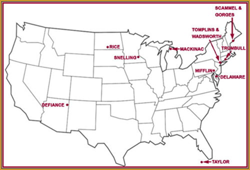
- The Eastman Forts
Fort Mackinac Michigan (1761)
Full Size Image | Printer Friendly
Fort Mackinac Michigan (1761) Fort Mackinac takes it name from the island on which it stands. Located on a high bluff, it overlooks the Mackinac Straits connecting Lakes Huron and Michigan. The fort is no longer an active military installation, although it figured prominently in the early history of the area. The French first fortified the south shore of the straits early in the eighteenth century. In 1761 the British occupied that fort during the French and Indian War, but they abandoned it in 1763 after an Indian attack caught the garrison by surprise. The British returned to the site in 1764. In 1780, believing the fort vulnerable to attack by American forces during the Revolutionary War, the British garrison moved to Mackinac Island. Although they ceded that fort to the United States in 1795, British forces captured it in 1812. American forces experienced a serious defeat in a futile attempt to recapture the fort in 1814. With the end of the War of 1812, however, Fort Mackinac finally became permanent U.S. property in 1815. 
Fort Mifflin Pennsylvania (1771)
Full Size Image | Printer Friendly
Fort Mifflin Pennsylvania (1771) Fortifications on Mud Island, site of Fort Mifflin, predate the Revolutionary War. The island is in the Delaware River, seven miles below Philadelphia. The British started building the first works, known locally as Mud Fort, in 1771. A British bombardment destroyed the first fort, occupied by Patriot forces, in 1777.
In 1795 a new fort erected on the site was named in honor of Pennsylvania's first governor, Maj. Gen. Thomas Mifflin of the Continental Army. In 1798 work began on a new masonry structure to replace the older works, and the new fort was completed two years later. The post was abandoned and reoccupied several times during the nineteenth century. Fort Mifflin was garrisoned during the Civil War, and Eastman was in command when the war ended. As the Army reduced its force structure at the end of the war, the post's garrison grew considerably smaller. The 1875 Surgeon General's report on hygiene noted that although the post had quarters for "one company of artillery," the facility was "in charge of an ordnance-sergeant." 
Fort Trumbull Connecticut (1775)
Full Size Image | Printer Friendly
Fort Trumbull Connecticut (1775) The structure depicted by Eastman is the third fort constructed on the same site with the same name. In 1775, recognizing the necessity of protecting harbors from British occupation, the General Assembly of Connecticut ordered fortifications prepared between the mouth of the river Thames and the town of New London. Named for Governor Jonathan Trumbull, the first Fort Trumbull, completed in 1777, was apparently a primitive affair designed solely to cover the river. Its fatal flaw, an open landward side, allowed British forces, led by the American Benedict Arnold, easily to overrun the fort's 23-man garrison from the rear and put New London to the torch in 1781. 
Forts Tompkins and Wadsworth New York (1776)
Full Size Image | Printer Friendly
Forts Tompkins and Wadsworth New York (1776) When Eastman painted this scene, the installation at the top of the hill was known as Fort Tompkins and the fortification at the waterline was Fort Wadsworth. Over the years, however, these fortifications, located on Staten Island west of the Narrows outside New York harbor, have had a variety of names. 
Forts Scammel and Gorges Maine (1808)
Full Size Image | Printer Friendly
Forts Scammel and Gorges Maine (1808) The U.S. government acquired the property of Forts Scammel, on the right in Eastman's rendition, and Gorges, on the left, early in the nineteenth century to build fortifications that would protect the harbor at Portland, Maine, from hostile invasion. Work on Fort Scammel began in 1808, the same year Eastman was born in Brunswick, a small town about twenty-five miles northeast of Portland. The fort was built on a twelve-acre site on House Island at the mouth of Portland's harbor. It was named for Alexander Scammel, the commander of the 1st New Hampshire Regiment, who was killed at Yorktown in 1781. A lighthouse presently occupies the site.
Construction of Fort Gorges, located on Hog Island, did not begin until 1857. It was named for Sir Ferdinando Gorges, the seventeenth century British Lord Palatinate of the Province of Maine. Work on the fort was completed about the time the Civil War ended, but it played no role in that conflict. 
Fort Delaware Delaware (1812)
Full Size Image | Printer Friendly
Fort Delaware Delaware (1812) Fort Delaware is located in the Delaware River on Pea Patch Island about forty-two miles downstream from Philadelphia. The island was first fortified with earthworks during the War of 1812. After a number of intermittent attempts to erect a permanent fort, Congress in 1847 appropriated $1 million to construct a permanent masonry fort on the site, and work began the following year. When the fort was finally completed in 1859, it had cost an additional million dollars. It was garrisoned by federal forces in 1861.  Fort Snelling Minnesota (1819)
Full Size Image | Printer Friendly
Fort Snelling Minnesota (1819) Located at the confluence of the Mississippi and Minnesota Rivers, Fort Snelling was established in 1819 on a bluff 100 feet above the river line. The stone buildings and walls shown in Eastman's rendering were constructed in 1830. The formidable bastion, named for Col. Josiah Snelling, commander of the 5th Infantry, which built the first defenses on the site, was never attacked of even seriously threatened. 
Fort Taylor Florida (1822)
Full Size Image | Printer Friendly
Fort Taylor Florida (1822) Fort Taylor now stands on Key West. The island became U.S. property when the Navy hoisted an American flag over it in 1822. The Army established a barracks on the north shore of the island in 1831, and in 1845 construction of Fort Zachary Taylor began on the southwest side, on a sandy shoal about 400 yards offshore. Three of the fort's four bastions overlooked and controlled the water approaches to Key West. When the Civil War began in 1861 the post was ready to be garrisoned, and Union forces occupied it during the entire war. 
Fort Defiance New Mexico (1851)
Full Size Image | Printer Friendly
Fort Defiance New Mexico (1851) When Congress commissioned Eastman to paint military installations, Fort Defiance had already been abandoned for some time. The Army had first used the site as a base of operations in 1851. By 1852 the fort boasted a number of pine log and adobe structures built around a parade ground. For ten years the post housed elements of several regiments while they engaged in campaigns against the local Indians. In 1860 Companies B, C, and E of the 3d Infantry successfully defended the fort against a Navajo attack. The onset of the Civil War in 1861 caused the Army to abandon the installation, although it saw a flurry of activity when Kit Carson briefly occupied the fort in 1863.  Fort Rice North Dakota (1864)
Full Size Image | Printer Friendly
Fort Rice North Dakota (1864) Established during the Sioux campaigns in 1864 on the western bank of the Missouri River, Fort Rice had a brief and uneventful life as an Army post. The Secretary of War named the fort for Brig. Gen. James Clay Rice, who had been killed in Virginia in May 1864. The original buildings, cottonwood logs with sod roofs, were built by the 30th Wisconsin Infantry. In 1868 the post was rebuilt; the original buildings were destroyed and new ones erected on their sites. The new fort was a quadrangle, 864 by 544 feet, surrounded by a 10-foot-high stockade. By 1875 the post included 4 company quarters, 7 buildings for officers, a hospital, a bakery, 5 storehouses, a library, a magazine, and a guardhouse. There were corrals, stables, and another storehouse outside the stockade. |